Monday 3rd June 2024.
Today was designated a day of site seeing as various interesting places were on the coast road we were taking northwards, we were up early and on the road before 9a.m.
We were to spend the day driving through a part of The Burren which is a region of County Clare approx 138 sq miles in size. It is a Karst landscape of bedrock incorporating a vast cracked pavement of glacial era limestone with cliffs, caves, fossils, rock formations and archaeological sites. People have lived in this region for over 12,500 years, they built cairns, communal cooking places, hill forts and ritual sites and buried their dead in Dolmens.
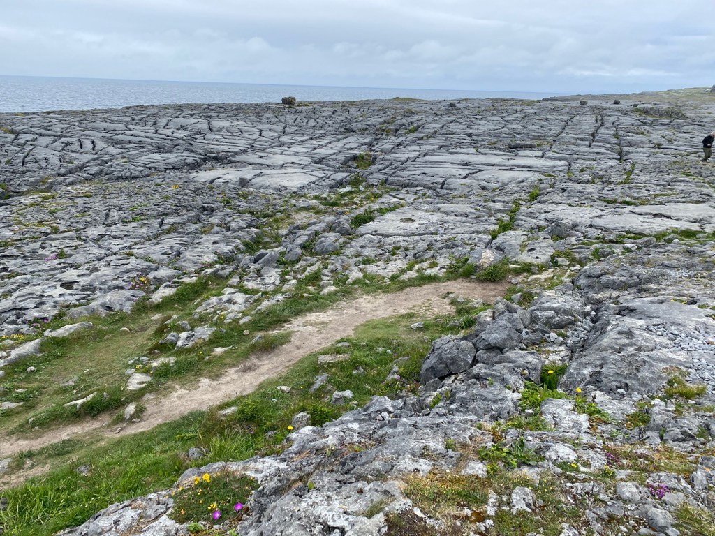

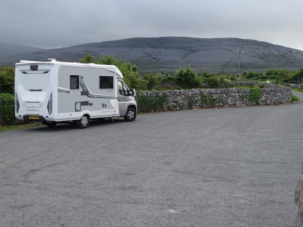
We were driving along the coastal edge of the region on a narrow road so it was difficult to take photos that show the area at its best, driving in land through The Burren would give a fantastic experience. Where we are parked tonight we are surrounded by a range of hills of the grey stone.
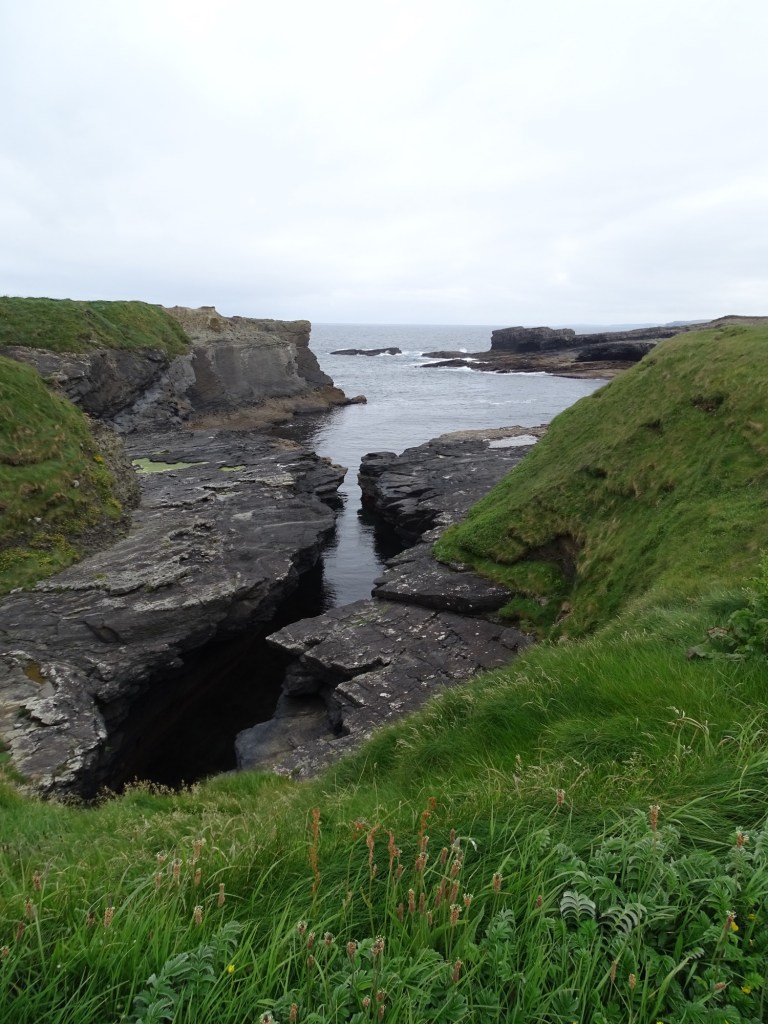
Our first stop of the morning was at The Bridges of Ross, these were originally 3 rock arches that spanned deep coastal incisions where the sea eroded the rock, sadly only one bridge survives today.
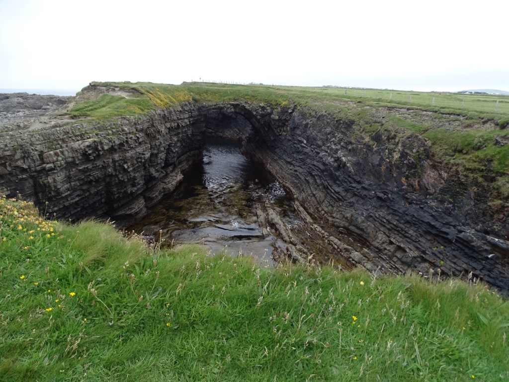

We didn’t walk too far along the cliffs even though there is public footpath as it was rather narrow and close to the cliff edge.

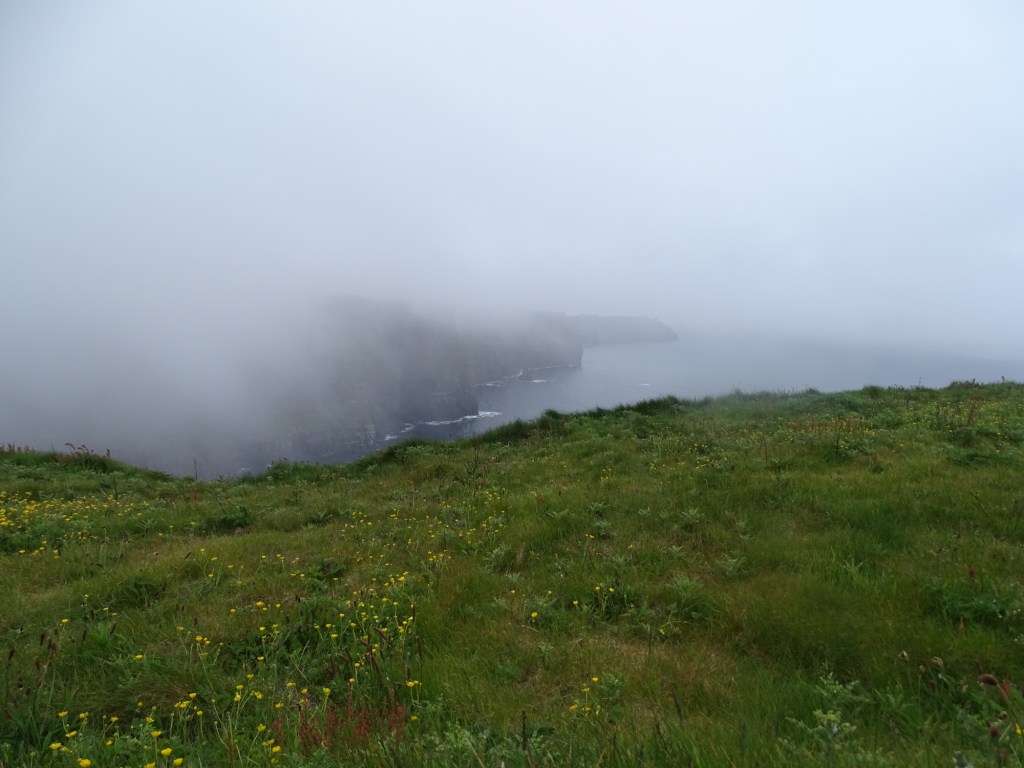
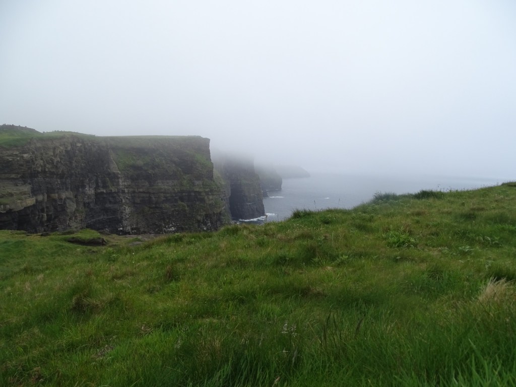
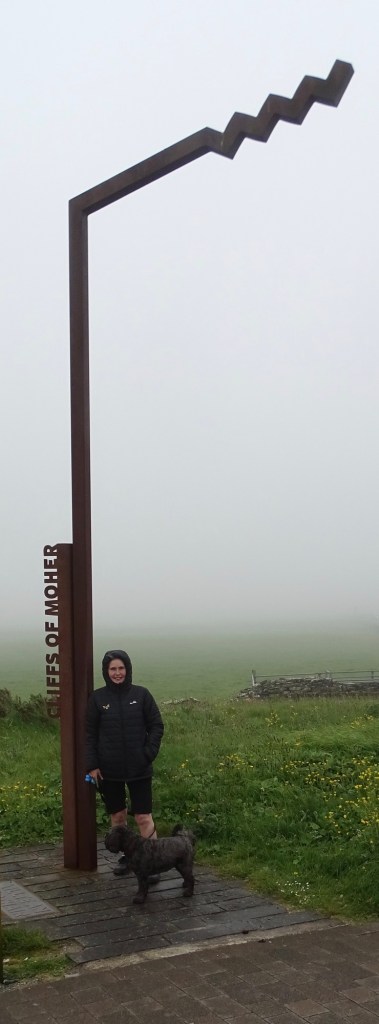
We retraced our steps from The Bridges and continued on the coastal road to the Cliffs of Moher. These are sea cliffs located on the SW edge of the Burren region, they run for about 14k in length, at the southern end they rise to 120m and at the northern end 214m above the Atlantic Ocean.As we got within a few kilometres of the Visitors centre a thick mist formed and it began to rain, as we pulled into the car park the attendant in the booth explained you can’t see anything and I don’t have the powers to know when you will be able to😊 so if you want you can leave without paying, it should be OK in a day or so. I thanked her kindly and said we would stop anyway and see what developed, we took a leisurely lunch break but it wasn’t any better but we took the plunge and walked from the car park to the cliffs area.
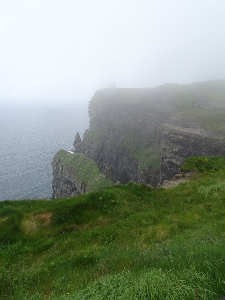
There are a series of paths and flights of steps that take you upwards , we initially took the left route and after a steep climb reached a viewing area.
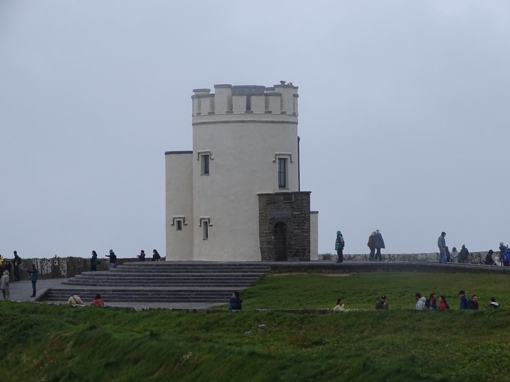
Dogs weren’t allowed along the cliff path and so we descended to the visitors centre and walked up,the steep steps to the other side where O’ Brian’s Tower is situated, Michelle walked up inside but as it was a metal spiral staircase I stayed back with Layla.
Obviously it was sad we didn’t get a better view but as we aren’t able to return on a finer day we had to take what was on offer and I’m pleased we made the effort.
We continued northwards on a minor coastal road towards Doolin where we followed the road and ended up at Doolin Pier which was a dead end, thankfully there was an area to turn round and head back. The road from there hugged the coast with spectacular views and in my mind was the best I’ve driven so far, the road was narrow and at times difficult as large vehicles came towards you but I still managed to catch glimpses of the view.
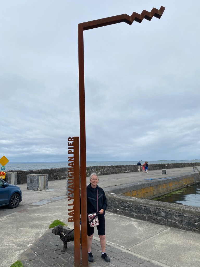
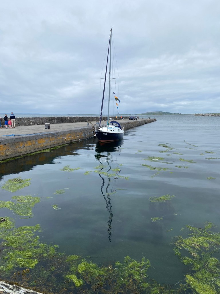
We stopped at Ballyvaughan for a wander around and went in a very pleasant tea room for a drink, it had a wonderful walled garden. Not far from there is where we are parked for the night at Corcomroe Abbey.
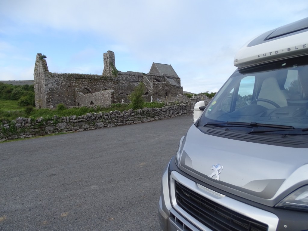

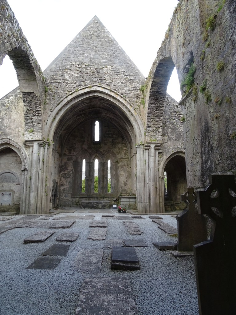
Corcomroe Abbey is on the edge of the rocky hills of the Burren, it was founded for Cistercian monks around 1195 as a daughter house of the Abbey at Inisloughnaght County Tipperary. In the chancel is the effigy tomb of Connor O’ Brian who died in 1268 and was King of the ancient territory of Thurmond.
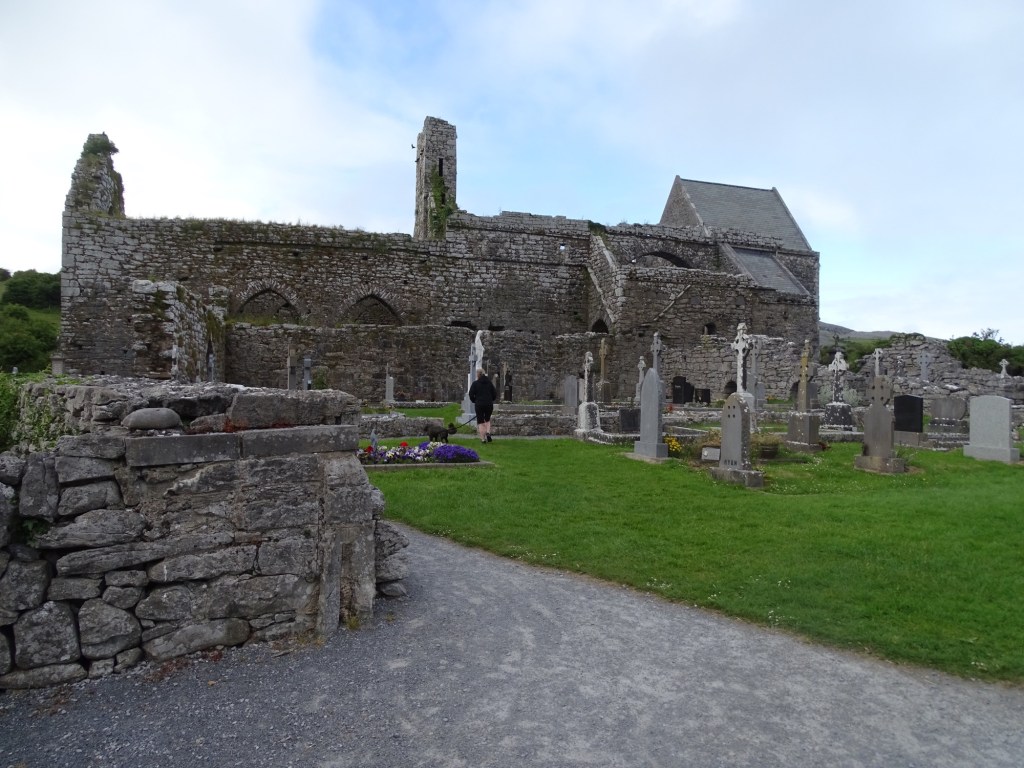

We are taking advantage of a free stop over, it’s very quiet as we are the only van here, we are however somewhat off the main road along a single track lane. People have been here tending the graves, apart from that we only have cows as neighbours.
